

The ocean never stands still. Neither do our lidars.
We are writing this from on board the French R/V Marion Dufresne during the WHIRLS expedition, surrounded by one of the most energetic ocean regions on the planet, in the middle of the Southern Atlantic Ocean. Beneath us, the ocean is shaped by fronts, filaments, eddies, and strong currents. Around us, multiple highly skilled scientific teams deploy instruments, monitor data, plan measurements, and adapt to whatever the ocean and weather decide to do next, supported by a highly professional crew.
As the “slow” ocean evolves over relatively small spatial scales (from one km to hundreds of km), it interacts with the “fast” atmosphere over a large range of spatial scales (from tens to thousands of km). The different dynamics of the ocean and the atmosphere generate the heat and gas fluxes that regulate their state at different scales, up to the climate. On top of these exchanges, atmospheric dynamics shape cloud formation and evolution, rain and other events.
Due to this rapid interaction and quick changes, we need to measure the atmosphere at a very high resolution. On board the ship, three lidars profile it every ten seconds.
Our main instrument is ARTHUS – the Atmospheric Raman Temperature and Humidity Sounder, developed at the Institute of Physics and Meteorology of the University of Hohenheim, Germany. Next to it, two Doppler lidars measure the wind.
Together with the ship’s atmospheric sensors, drones, and radiosondes, the lidars allow us to continuously observe atmospheric behaviour over the ocean at high resolution.
Looking up from a moving research lab
ARTHUS sends laser pulses vertically into the atmosphere and measures the weak, Raman-scattered light returning from atmospheric molecules. From these signals, we retrieve profiles of temperature, water vapour, aerosols and – for the first time in this type of deployment – CO₂ above the vessel. From the layers of moisture and temperature above the ship, together with aerosol and cloud structures, we may observe clouds forming and disappearing directly above us, or rain approaching in real time.
The two Doppler lidars add the atmospheric dynamics. The first tells us how air masses are moving upward and downward, giving us insight into turbulence and vertical transport. The second helps us describe the larger-scale flow and its variation with height. While ARTHUS reveals the thermodynamic structure of the atmosphere, the Doppler lidars show us how the atmosphere responds to changes at the ocean surface, and how these processes are connected.
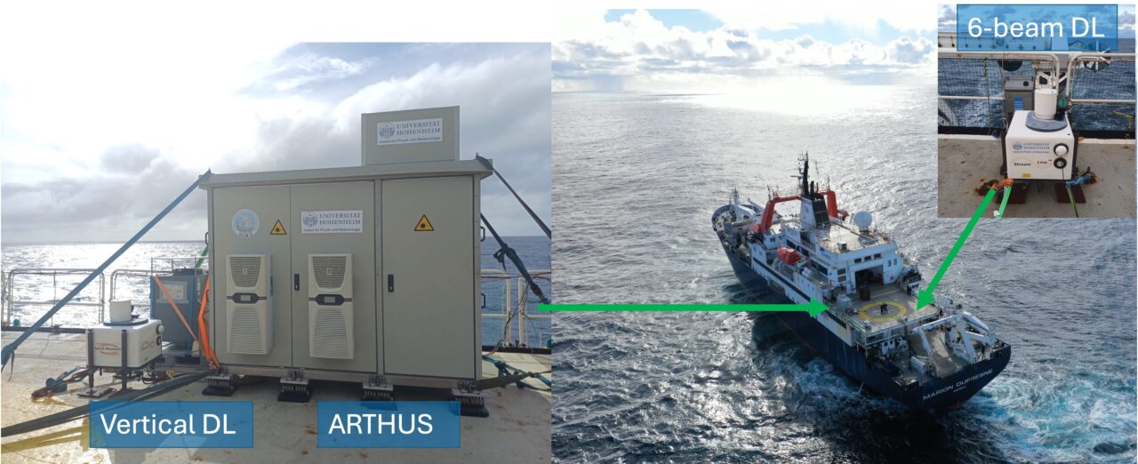
The real strength of this setup lies in the combination of these measurements. By bringing together high-resolution observations of temperature, water vapour, vertical velocity, and horizontal wind, the three lidars allow us to go beyond describing the mean state of the atmosphere. Their synergy enables us to investigate atmospheric turbulence and derive turbulent quantities associated with the exchange of energy and moisture.
In particular, the combined measurements can be used to estimate turbulent sensible and latent heat fluxes, together with the associated turbulent variables and statistics. In other words, we can investigate not only how warm, humid, or windy the atmosphere is, but also how turbulence transports heat and water vapour vertically through the maritime boundary layer.
Crossing a front – and watching what happens above it
On a map, an ocean front can look like a line separating two water masses. From the ship, the experience is much more dynamic. The sea-surface temperature, current, and air-sea fluxes may change. The maritime boundary layer above us may adjust.
The ocean and atmosphere interact continuously, across different spatial and temporal scales. When the ship crosses from one oceanic regime into another, we watch the lidar measurements, and observe: Does the humidity structure change? Does the temperature profile respond? Do we observe stronger vertical motions? Does the horizontal wind change with height?
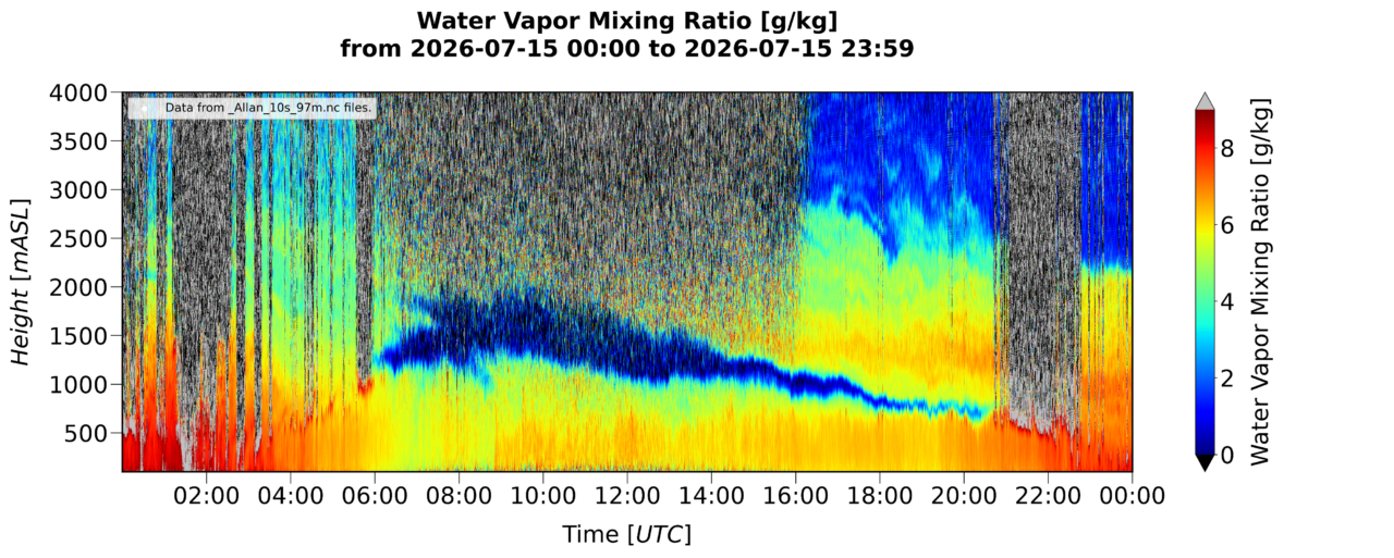
While we do not yet know exactly what the full dataset will reveal, that will take careful processing and extensive analysis after the expedition, we are already seeing the atmosphere change above a moving and highly structured ocean.
As our vessel keeps moving and the ocean keeps changing, the lidars keep looking up.
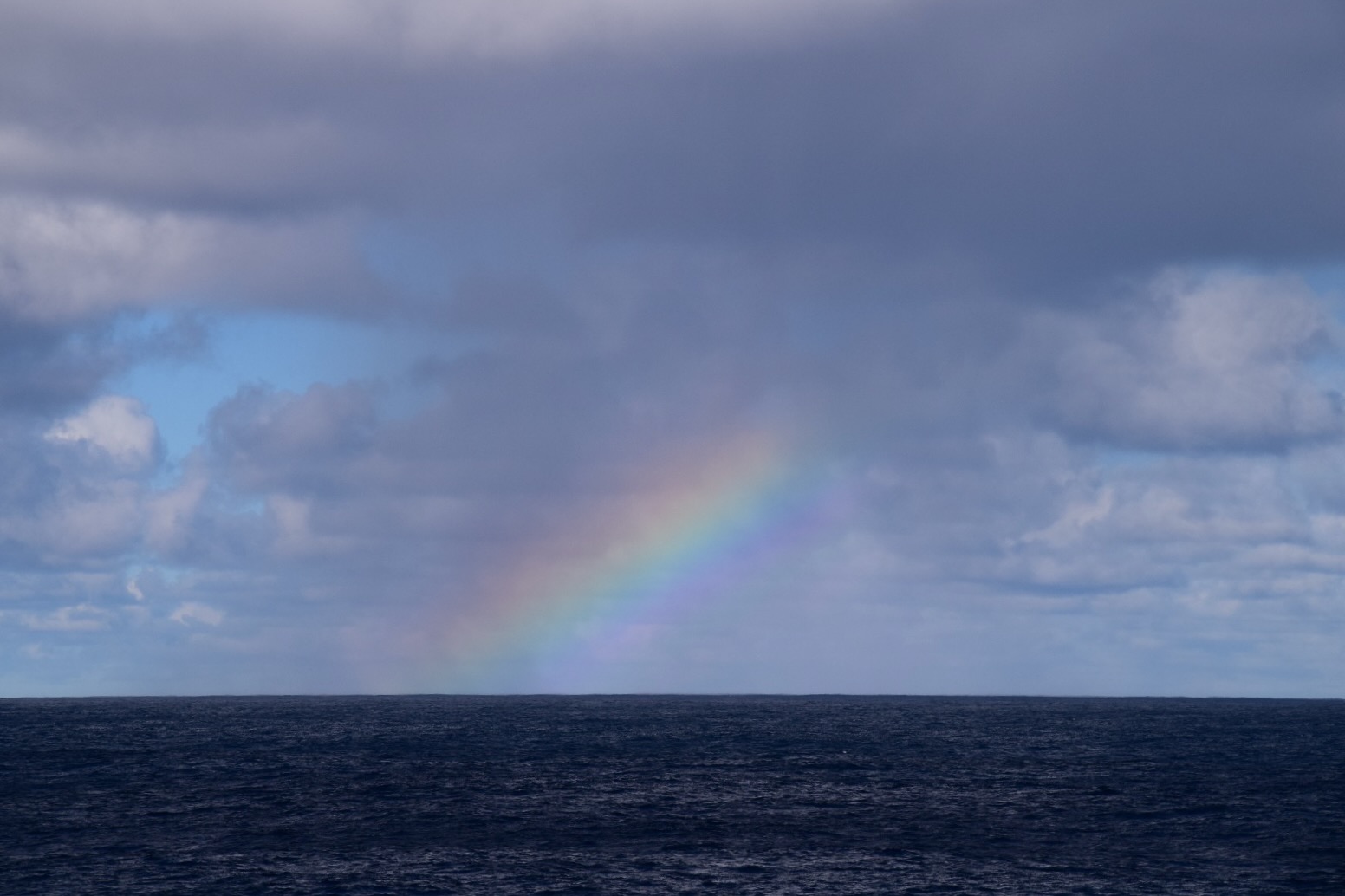
Featured image: A beautiful view of the atmosphere.
Author: Diego Lange, Agostino N Meroni