
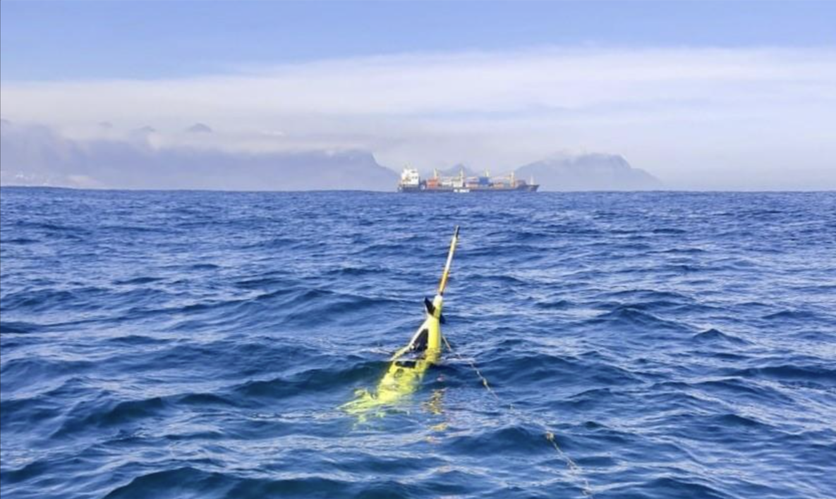
On September 17th, the WHIRLS team launched its first set of ocean gliders off the coast of South Africa — marking a major milestone for the project. This deployment serves two key purposes:
- Testing the glider platforms in real-world conditions, especially given the highly energetic currents of the Cape Basin.
- Beginning observations in WHIRLS’s study region.
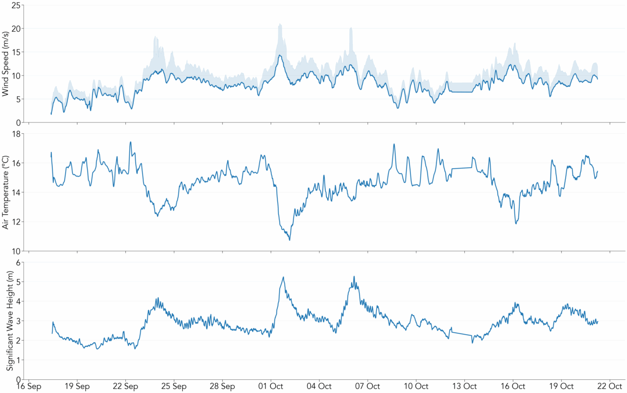
Over the coming weeks, the gliders will collect continuous data as they navigate through the area. This mission also offers a unique opportunity for new pilots to gain hands-on experience in monitoring and guiding the gliders, while experienced pilots continue piloting and provide mentorship. As new pilots build confidence and skills, they’ll take on greater responsibilities in glider operations.
This deployment was carried out in partnership with Sea Technology Services, as part of a resupply mission to a remote South African field station on Gough Island. Scientists from the University of Gothenburg led the launch, deploying two types of autonomous platforms:
Seaglider
Wave Glider
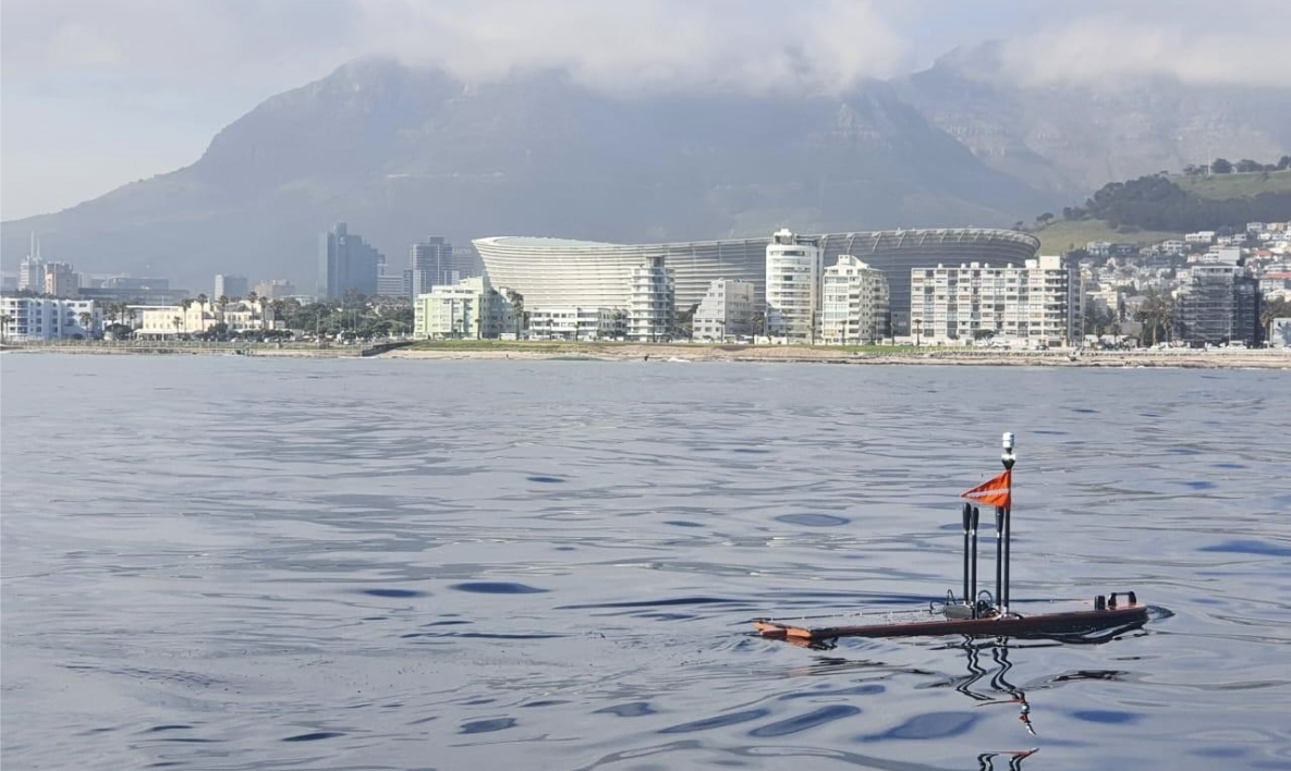
Working together, these complementary gliders will collect detailed, multi-dimensional observations of the air-sea interface and ocean interior, providing valuable insights into the heat and carbon exchange between the ocean and atmosphere—key processes for understanding climate dynamics.
What Have We Observed So Far?
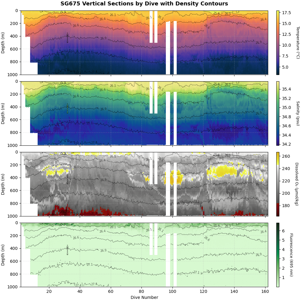
The gliders have primarily been moving from west to east, navigating through a region that includes a prominent seamount.
Seamounts are suggested to play a major role in ocean dynamics. These underwater mountains disrupt ocean currents, generating eddies, turbulence, and enhanced vertical mixing. As water is forced to rise and sink around the seamount, it brings cold, nutrient-rich deep water closer to the surface in a process known as upwelling. This mixing redistributes heat, oxygen, salinity, and nutrients, which in turn supports high levels of biodiversity. Seamounts are often biological hotspots, hosting unique communities, many of which are endemic (found nowhere else on Earth).
What’s Next?
The gliders will continue their eastward journey, trying to get closer to Cape Town and collecting data over the next weeks to months. These observations will help researchers better understand the physical processes driving air-sea interactions in this remote and energetic part of the ocean.
Follow Our Journey!
You can track our gliders in near-real time here.