This page provides a short overview of different observational methods used within WHIRLS.
Seasonal timeseries
Our platforms are currently in the water, measuring both at the surface and profiling at depth, follow their trajectory and live data here, and links to completed missions in the table below.
Platform
Duration
Link to dataset
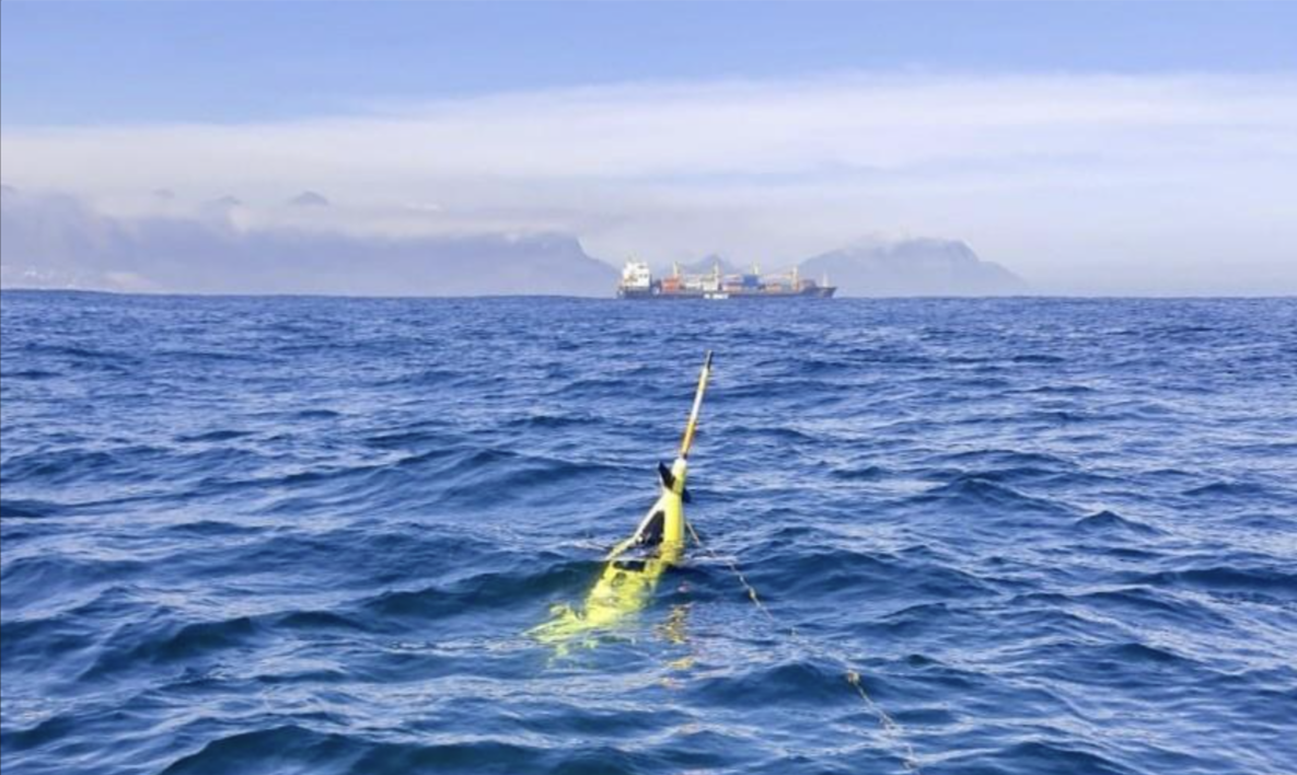
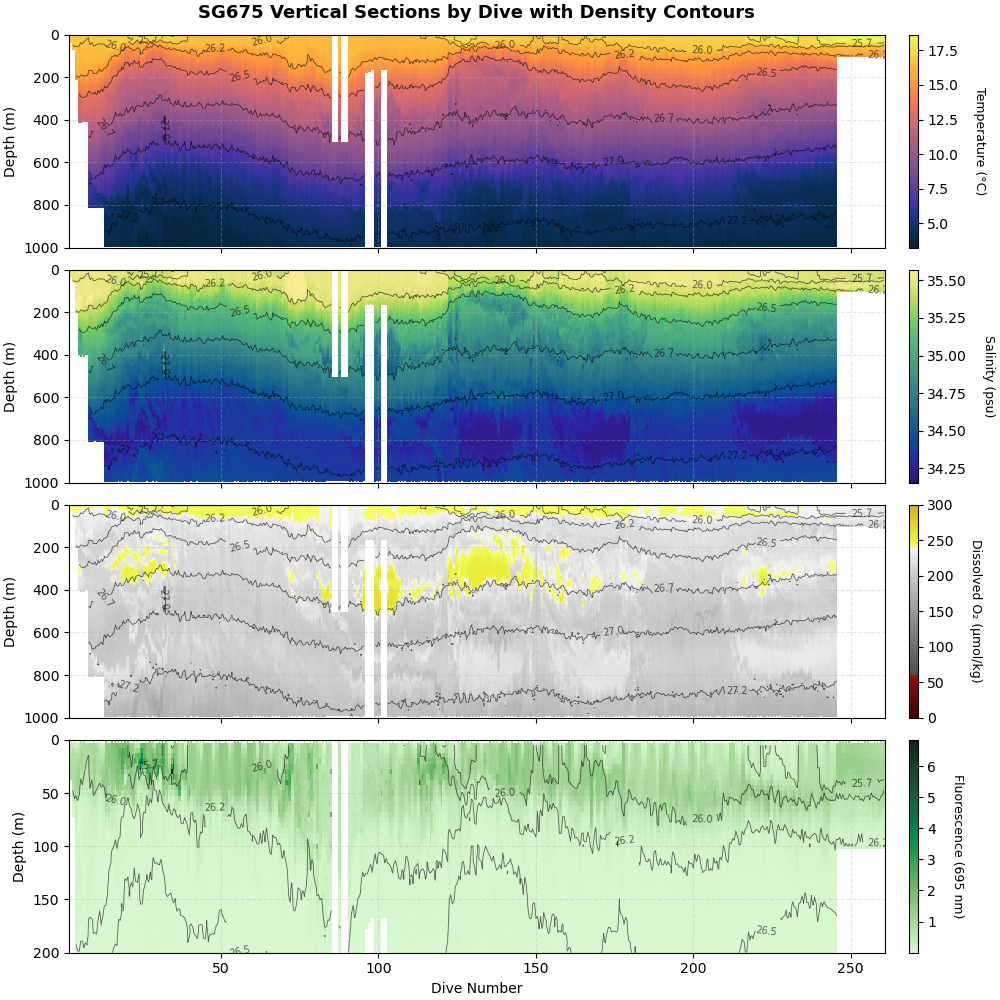
Seaglider 675
Sept-Nov 2025
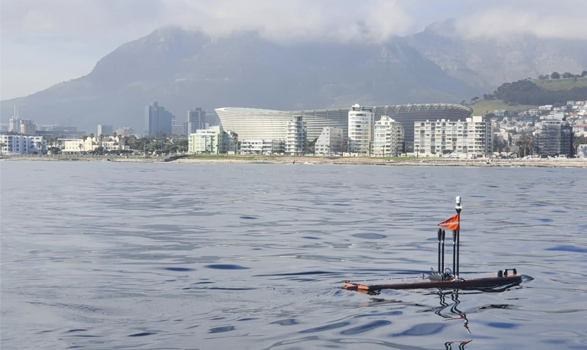
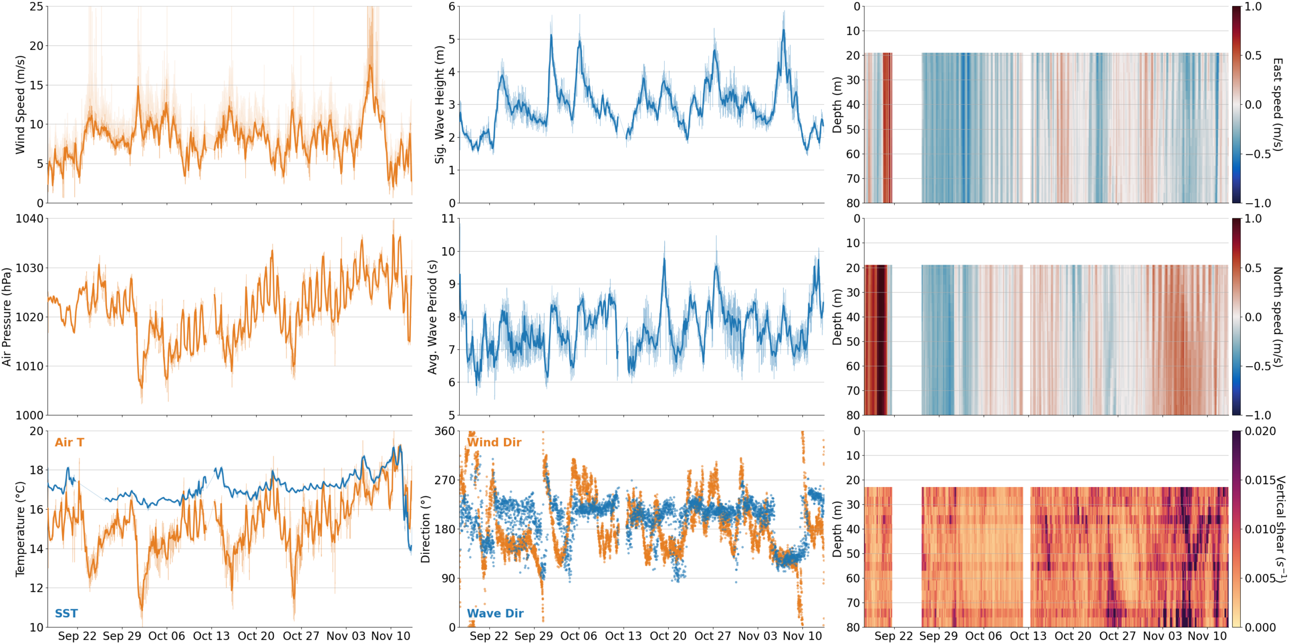
Wave Glider 1170
Sept-Nov 2025
Seaglider
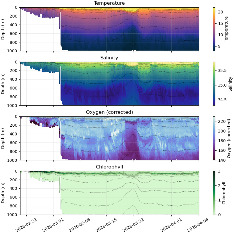
The Seaglider can dive to depths of up to 1000 meters, gathering data on temperature, salinity, and other ocean properties throughout the water column. These measurements allow us to identify where vertical and horizontal mixing is occurring and where turbulence is strongest. This vertical mixing is critical—it drives heat distribution, carbon storage, nutrient cycling, oxygen transport, and contributes to ocean circulation and global climate regulation.
Wave Glider
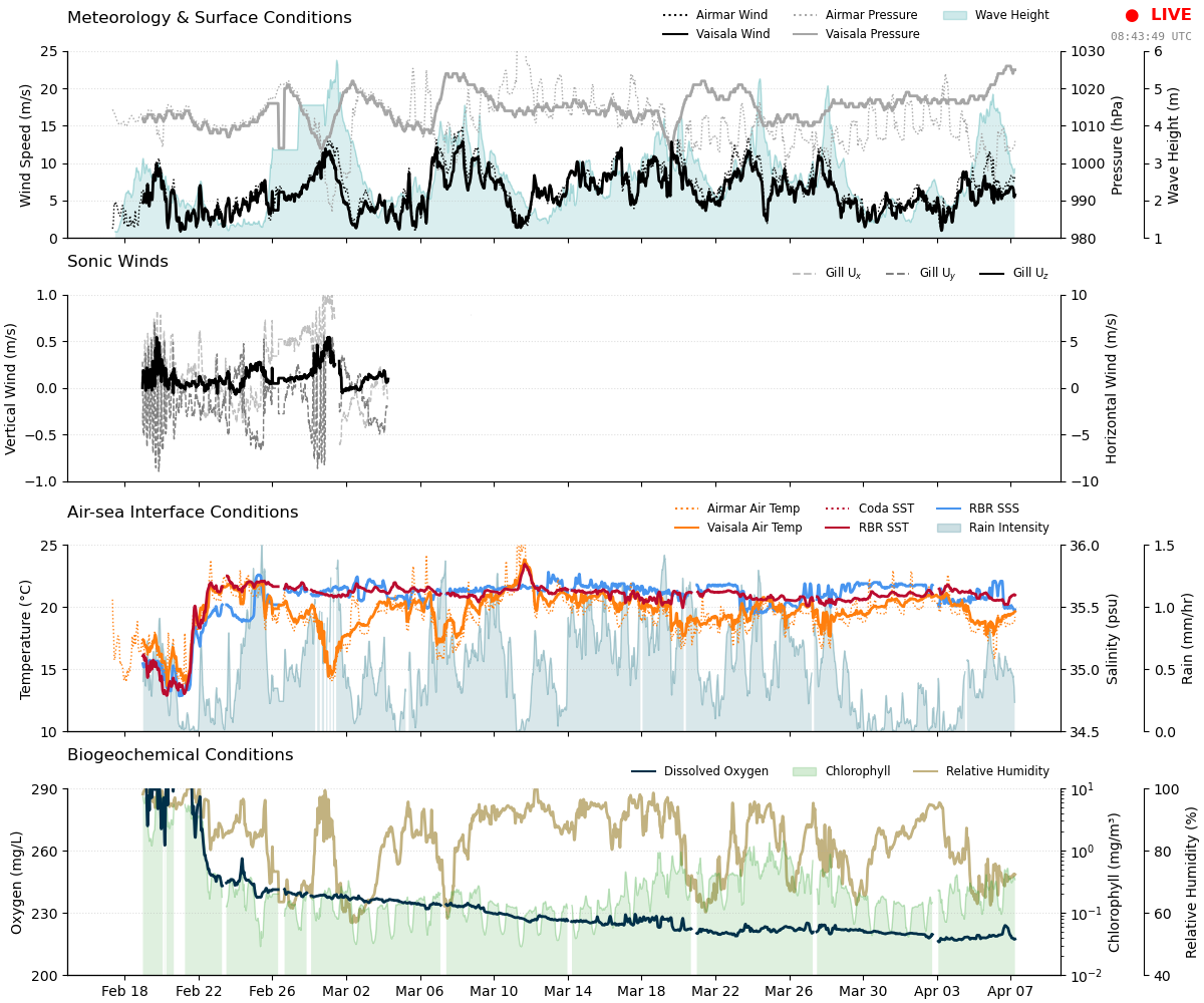
The Wave Glider operates at the surface, nominally equipped with sensors to measure wind, air speed and pressure, and current velocities down to 100m. Following the same path as the Seaglider, it provides valuable context of the ocean surface and atmospheric conditions, as the atmosphere is the major driver in the near-surface turbulence that drives the mixing that the Seaglider observes.
First observational datasets
Subsurface data from the Seaglider 675 mission between September-November 2025
Surface data from the Wave Glider 1170 mission between September-November 2025
Subsurface data from the Seaglider 267 current mission from February 2026 and onwards
Surface data from the Wave Glider 1170 current mission from February 2026 and onwards
You are currently viewing a placeholder content from Turnstile. To access the actual content, click the button below. Please note that doing so will share data with third-party providers.